Category: Sin categoría

  • What is a multispectral camera and how does it work?

    What is a multispectral camera and how does it work?

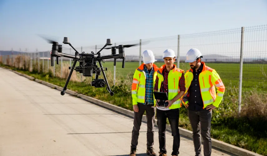
    As we have mentioned in previous articles, the uses of professional drones have been expanding more and more thanks to the wide range of advantages they offer. One of the most outstanding features of drones is that they allow to adapt different elements to improve their performance, and multispectral cameras are an important part of these components.

    In this article we will explain what a spectral camera is and how it works, and its different uses and applications for drones.

    What is a multispectral camera?

    As its name suggests, it is a type of camera that has the ability to capture different spectra or images beyond the range visible to the human eye. This is because they can detect radiation in different wavelengths or spectral bands, such as near infrared (NIR), mid-infrared (MIR) or thermal infrared (TIR).

    How do multispectral cameras work?

    Multispectral cameras work by using specialized sensors that can detect radiation in different bands of the electromagnetic spectrum. The multispectral sensor is composed of several pixels sensitive to different wavelengths, meaning that each pixel is designed to detect the amount of radiation in a specific band of the spectrum.

    Because each pixel records different information, a variety of data can be captured and results can be obtained for specific analyses, which can be useful for a variety of purposes.

    Uses of multispectral cameras on drones

    Multispectral cameras on drones are used for a wide range of applications, including the following:

    • Precision agriculture: these cameras are valuable tools for assessing crop health, detecting diseases, pests and nutritional deficiencies.
    • Environmental monitoring or remote sensing: multispectral cameras help in monitoring water quality, detecting oil spills and assessing vegetation in hard-to-reach areas.
    • Mapping and surveying: these cameras are useful for creating detailed maps and generating high-resolution three-dimensional models, so they are highly used in drone surveying.
    • Fire detection: multispectral cameras can detect heat emitted by fires, analyze near-infrared smoke characteristics, calculate vegetation indices to identify affected areas, and generate thermal and fire spread maps. This has made firefighting drones a fundamental tool for prevention.
    • Security and surveillance: drones with multispectral cameras provide a more complete and accurate view, allowing the detection of hidden objects and the identification of potential risks.

    Multispectral camera for precision agriculture

    Precision agriculture is one of the most relevant uses for drones with multispectral cameras. By having a multispectral camera for environment and agriculture, they offer farmers the ability to manage their crops, soil, fertilizer and irrigation more efficiently.

    Benefits of multispectral camera use

    Drones in agriculture with spectral cameras are a valuable tool for farmers in making the right decisions in the management of their crops, as they offer the following benefits:

    • They allow detecting pests, diseases, nutritional deficiencies and other conditions that could affect plant health.
    • They provide accurate information on each stage of the crop, to adjust fertilizer and pesticide applications more precisely, identify areas of water stress and improve irrigation efficiency.
    • They are ideal for managing plant distribution and evaluating crop yield.
    • They help reduce chemical use, water wastage and at the same time increase crop yields.
    • Thanks to their efficient results, you can save time, money and reduce the use of pesticides.

    Differences between multispectral camera and thermographic camera

    Multispectral cameras and thermographic cameras are two types of cameras used for different purposes, so the main difference between them is the type of information they capture.

    A multispectral camera captures images in different bands of the light spectrum, beyond what our eyes can see. This means that it can capture information in colors that we cannot normally perceive.

    On the other hand, a thermal imaging camera captures infrared radiation emitted by objects. This makes it possible to visualize temperature differences and create thermal images.

    Becoming a professional drone pilot with a multispectral camera

    At UMILES University we give you the opportunity to train professionally through our complete drone pilot course, but you can also specialize through the course of precision agriculture with drones, so you can master everything related to the use of drones and their various components, such as multispectral cameras that have become essential elements for this field of application.

  • What is Geocaging? How this system works on drones

    What is Geocaging? How this system works on drones

    One of the most interesting developments related to drones is the geocaging system, which is presented as a versatile tool that can be used in different fields of work. Its main advantage is that it allows to define specific routes and limit the path of a drone in a precise way, so it has taken great relevance among the different uses of professional drones.

    Continue reading this article where we will explain everything related to the geocaging system in UAS, and its main applications for the operation of a drone.

    What is Geocaging drones?

    Geocaging is a system that allows drones to fly within a predefined geographical area and restrict their movement outside of it. This technology is based on the use of precise geographic coordinates, together with a combination of software and hardware to establish flight limits. It will therefore make it possible to delimit the space in which a drone can operate.

    This is essential in different fields of application, and especially to prevent these aircraft from entering restricted airspace for drones, such as SPA areas. Also when we want to make a recording with drones in a specific place and we do not want the drone to leave that specific area.

    How does the geocaging system work in drones?

    The functioning of the geo-caging system will depend on three main elements: the drone, the positioning system and the geocaging software.

    • The drone: it must be equipped with a GPS receiver that allows it to know its exact location at all times. This is essential to ensure that the drone stays within the established limits.
    • Positioning system: this is used to determine the precise location of the drone in real time. This information is used to compare it with the established coordinates of the permitted geographic area.
    • Geocaging software: it is responsible for establishing and managing the geographical limits where a drone can fly. Thanks to the software, the operator can define a specific area using geographic coordinates or by drawing a custom shape on a map. In addition, it also notifies the operator if the drone approaches or crosses the established limits.

    What are the advantages of geocaging in drones?

    Drone geocaging offers a number of significant benefits, such as those listed below:

    • Safety: By restricting the drone’s flight to a specific geographic area, the risk of the drone invading restricted or hazardous areas, such as airports, controlled airspace or private areas, is reduced.
    • Regulatory compliance: Geocaging helps to comply with regulations and restrictions set by authorities.
    • Privacy protection: By preventing drones from flying over private property without authorization, it therefore helps protect people’s privacy and prevent misuse of the technology.
    • Precise flight control: Geocaging allows precise control over the area in which the drone can operate. This is especially useful in applications such as mapping, industrial inspections or precision agriculture, where it is necessary to cover specific areas. This is why drones in agriculture are becoming essential tools.

    Where can’t a drone be used?

    In Spain, the use of drones is regulated by the Spanish Aviation Safety Agency (AESA) and there are some restrictions on where a drone cannot be used.

    • Controlled airspaces: Drones cannot be flown in airports, heliports or areas where there is controlled air traffic. The minimum distance is usually 8 kilometers.
    • Urban areas and agglomerations of people: It is forbidden to fly over urban areas with a large population or where there are agglomerations of people, such as sporting events, concerts, demonstrations or other public gatherings.
    • Military and security zones: A drone may not be used near military installations, military bases, restricted areas or any place where there are national security activities.
    • National parks and nature reserves: In national parks and other protected areas, there are restrictions on the use of drones to avoid disturbing wildlife and the natural environment. Each park may have its own specific regulations.
    • Private spaces without permission: You cannot fly a drone over private property without the owner’s permission. It is important to respect the privacy of people and their property.

    On the other hand, you can fly a drone on the beach as long as you respect the privacy rules for people and the distances allowed by the drone regulations in Spain. Otherwise its use will be restricted.

    Now that you know what geocaging is and its importance in drone flight, you can’t hesitate to start using this system in your controlled flights.

    Do you want to work as a drone pilot?

    If you want to specialize in the world of UAS and work as a professional drone pilot, we recommend you to take one of our drone courses. We invite you to take a look at our professional drone pilot course, through which you can get certified according to the current AESA drone regulations in Spain. Don’t wait any longer and request information now!

  • Drone Regulations in Spain 2023: UPDATED

    Drone Regulations in Spain 2023: UPDATED

    The AESA drone regulations have been undergoing a series of updates and adjustments, following the consolidation of the European regulations to govern the use of UAS in the country, which came into force from 31 December 2020. Since then, some deadlines have been set to comply with the new UAS requirements, so it is important to know the new adjustments to the 2023 drone regulations in Spain, and the changes that are going to be applied in the coming months.

    Drone legislation in Spain

    The AESA is the regulatory body for all drone activity in the country, and is responsible for issuing authorisations or permits to fly a drone in accordance with the new UAS regulations in Spain.

    At the moment, the new classification according to the types of drones and their characteristics has already come into force, which is defined according to the risk involved in the activity to be carried out with the drone. This groups drones into 6 classes ranging from C0 to C6, which can fly in three different categories: open, specific and certified. The latter is for higher risk flights and is currently under development at European level. However, all of them will require the pilot to be certified and have a drone licence.

    Changes to AESA drone regulations for 2023 and 2024

    The drone law in Spain currently has several deadlines to make the necessary adjustments to comply with the new European regulations. Specifically, there are several changes that must be taken into consideration.

    UAS that are going to operate in open category and that do not belong to any of the classes established in the EU Delegated Regulation 2019/945 (C0, C1, C2, C3 or C4) may be used until 31 December 2023, under these conditions:

    • If its take-off mass is less than 500 grams and it is to operate in subcategory A1, it must be flown by a pilot who is familiar with the manufacturer’s instructions.
    • If the drone has a MTOW of less than 2kg and is used at a distance of at least 50 metres from people, the pilot must have a basic or advanced drone operating certificate and must have completed self-practical training.
    • In case of a drone with MTOW less than 25kg that will operate in the A3 subcategory, the pilot must hold a basic or advanced certificate according to Law 18/2014 or Royal Decree 1036/2017.
    • UAS that comply with the marketing directive but do not belong to classes C0, C1, C2, C3 or C4 set out in EU Delegated Regulation 2019/945, may continue to be used only if they have been entered into the EU before 1 January 2024, and if they comply with the following conditions:
      • Their MTOW is less than 250 grams, including their payload, and they will operate in subcategory A1.
      • If its MTOW is less than 25kg, including fuel and payload, it will operate in subcategory A3.

    Other important changes to the regulation on drone flying in Spain by 2023

    • From 1 January 2024, drones used in the open category must belong to one of the classes C0, C1, C2, C3 or C4 set out in Delegated Regulation (EU) 2019/945.
    • From 1 January 2024, operations in the European standard scenarios must be conducted with drones having a Class C5 or C6 identification label, according to the standard scenario ‘STS-ES-01’ or ‘STS-ES-02’ respectively.
    • From 1 January 2023, all UAS operations of model aircraft clubs and associations shall be based on EU standards.
    • Depending on the operational characteristics, from 1 January 2023, model aircraft clubs or associations will have to apply to EASA for authorisation to conduct UAS operations.
    • From 1 January 2023, privately built UAS will be able to operate in compliance with an authorisation granted to a model aircraft club or association.

    What do I need to fly a drone in Spain?

    According to the new regulations, the drone pilot must meet certain requirements to fly a drone safely. In this case, a 4-level training scheme is taken into consideration that defines when a drone licence is required, and in which cases a certificate is needed or just familiarity with the manufacturer’s user manual.

    Basically, drones weighing less than 250 grams have the fewest restrictions, as they are categorised in EASA Class C0. In this case, the pilot is only required to be familiar with the drone manufacturer’s manual, and to register as a drone operator with AESA.

    For more information, please refer to our blog article on how to get a drone licence in 2023, so that you know exactly what is required to fly a drone in Spain according to each of the AESA categories.

    Which drones need a licence in Spain?

    The airspace in Spain is structured within the AIP-SPAIN, and is divided into Controlled Airspace and Uncontrolled Airspace. ENAIRE, one of the providers of air traffic management and air navigation services in Spain, makes available to all pilots the ENAIRE Drones web service, a map for flying drones your drone and which offers all the relevant information on the areas permitted for flying your drone, as well as NOTAMs and other data that may be important for operating drones safely.

    Where can I fly a drone weighing less than 250 grams in Spain?

    According to a statement from the AESA, people who want to fly a drone weighing less than 250 grams must do so under the standards of the European UAS regulation, if the drone has a sensor capable of capturing personal data such as camera or microphone, as well as when it is a drone that exceeds 80 joules of kinetic energy for its maximum speed, as is the case with racing drones.

    This means that you must comply with all the guidelines established by the EASA, unless the drone is classified as a toy. If you want more detailed information, you can go to our specialised article where we tell you where to fly drones in Spain.

    ¿Qué drones necesitan licencia en España?

    Depending on the type of drone and the activity to be carried out, the new drone regulations require the pilot to be certified in certain types of operation by means of a drone pilot course carried out through an organisation validated by the AESA, i.e. an ATO or Approved Training Organisation.

    At UMILES University we give you the most complete range of drone pilot courses, with the different certifications required by the AESA so that you can become a professional, and thus be able to obtain all the permits or licence required by the Spanish Aviation Safety Agency, depending on the type of flight you wish to perform.

    What will be required for UAS operations under the certified category in Spain?

    Although it is currently under development at a European level, we can be aware of the limits and stipulations that drones operating in the certified category will need and, due to the complexity it shows, it will require certification of the UAS by EASA. These types of drones are the ones that mainly comply with these characteristics:

    • Size of 3 metres or more.
    • Certified design to carry out operations involving the transport of dangerous goods and/or people.

    It should be noted that according to the type of activity that the drone is going to carry out, it is possible that the EASA may demand greater requirements, and even that a licence may be requested for drones and operations with different characteristics to those previously mentioned, so if you are going to operate in the certified category, you will always have to corroborate the viability with the approval of the EASA. Check their website for more details and updated information before flying your drone.


  • How to register as a UAS Drone Operator in 2023

    How to register as a UAS Drone Operator in 2023

    Regardless of whether you use your drone for recreational or professional flying, it is now necessary to register as a drone operator so that you can legally identify yourself to the AESA. This is a fundamental procedure, as even if you do not need a drone licence, most UAS require this procedure to be able to fly and avoid being sanctioned.

    What is UAS operator registration?

    Drone operator registration is a procedure in which the drone operator’s personal information is stored in the EASA database. In this way it is possible to keep track of all pilots and drone operators, so that their actions can be identified wherever UAS flights are performed.

    Why is it necessary to register as a drone operator?

    As of 31 December 2020, and with the entry into force of Implementing Regulation (EU) 2019/947, EASA makes it mandatory to register as a drone pilot. This registration helps to identify pilots and their drones, by means of a unique code that is assigned to each pilot who wants to become a drone operator.

    The drone operator registration code at AESA must be placed on the different RPAS used by the pilot, by means of an identification plate that must be located in a visible area of the drone. This will make it possible to identify who owns the UAV in case it falls and gets lost or causes an accident or damage to third parties.

    registrarse como operador de drones

    Where do I register as a drone pilot?

    The regulation establishes that drone pilot registration must be carried out in the member state where the operator resides. In the case of Spain, drone pilot registration is carried out at the AESA Electronic Headquarters, by means of a series of data that must be completed and sent in order to make the application.

    How to register as a UAS drone operator?

    The process is quite simple, and can be done with or without a digital certificate. All you have to do is go to the “Catalogue of procedures and services” and select the option “UAS operator registration”.
    Before making the request, it is necessary to create an account on the platform in order to be able to follow the procedure step by step. On the same EASA platform you will find all the necessary documents to make the application, such as the “UAS Operator Registration Guide”.
    Follow the indications in this guide, filling in the data that will be requested in each part of the registration, and check back in case you have any doubts about how to fill in the registration.

    Which drones must be registered with AESA?

    There is a wide variety of types of drones depending on their use, so the AESA establishes the characteristics that drones must have in order to be registered as an operator with the AESA. Basically, they must be registered when using any of the following types of UAS:
    In operations within the ‘open’ category:
    – All those drones that have 250g or more MTOM, or in case of collision with a human are capable of transmitting a kinetic energy of more than 80 joules.
    – All drones that have elements that allow the capture of personal data, such as cameras, microphones and other information gathering sensors. This includes drones of less than 250g MTOM that are not considered as toys.
    In operations within the ‘specific’ category:
    – Using a UA of any MTOM.
    The only drones that do not require the pilot to be registered in order to use them are those that are considered as toys (Directive 2009/48/EC).

    hacerse operador de drones

    What do I need to become a drone operator?

    To become an operator of this type of aircraft, you need to prepare yourself to know how to fly a drone, through specialised drone courses like the ones we offer at UMILES University. We invite you to take a look at the most complete, the professional drone pilot course, in which you can acquire from the basic theoretical knowledge such as what a drone is for, to the technical aspects that govern the flight of this type of unmanned aircraft, such as the drone licence..


  • Can you fly a drone on the beach?

    Can you fly a drone on the beach?

    Can I fly a drone on the beach? This is one of the questions frequently asked by those who want to get impressive aerial shots in an environment of sun and sea. But before flying a drone on a beach, it is important to know the regulations and rules that apply to flying RPAS drones in this type of area.

    Regulations for the use of drones on beaches in Spain

    Current regulations indicate that you can fly a drone on the beach as long as you take into account the AESA 2023 drone regulations and standards. Therefore, the following are the highlights of the current regulations:

    • Areas within aerodrome safety distances: Drones are not allowed to fly except with aerodrome/airport coordination.
    • Flight times: You can fly both during the day and at night. However, you should be aware that night flights are subject to certain requirements: the drone must be equipped with navigation and anti-collision lights, as well as a flashing green light. In addition, the weather conditions for taking off must be favourable (no fog, no wind, no rain).
    • Maximum flight height: The height of 120 metres from the lowest point on the ground may not be exceeded.
    • Drone vision: The drone must always remain within the pilot’s line of sight (VLOS). However, if you are licensed to fly in STS-ES-02 national standard scenarios, you can move the drone further away from the pilot’s view (BVLOS).
    • Respect for privacy: You may not film private individuals without their permission. The Personal Data Protection Act must be respected.

    Find out how to obtain a drone licence in Spain in case you need to fly a special type of UAS in our professional drone pilot course.

    sobrevolar playas urbanas con drones


    How to fly a drone on the beach?

    In addition to knowing the regulations and rules that apply to flying drones on the beach, it is important to take into account other aspects when doing this type of activity, as the conditions may be harmful to the drone or you may incur fines due to ignorance.

    This is why you should take the following points into account:

    • Protect your drone: Sand poses a risk to drones, so you should avoid getting the grains to damage the device. It is best to take off and land the drone by hand or with a take-off platform.
    • Avoid bad weather: Wind and rain can complicate drone flight. It is therefore important to keep an eye on weather forecasts to avoid wasting time. Also, due to the intense sun on the beach, it is advisable to use an ND filter and avoid flying in low or high temperatures.
    • Find out about Special Protection Areas for Birds (SPAs): Many of the best beaches are categorised as SPAs, which does not mean that you cannot use a drone on the beach, but you must apply for certain permits before doing so.
    • Check flight restrictions: Flight restrictions are changeable, so it is advisable to use virtual maps such as ENAIRE drones to read NOTAMs or check if there are any impediments to carry out the project on the beach.

    If you do not know what a NOTAM is, you can go to our blog article where we explain in detail what this type of notifications are about.


    How to fly a drone in high winds?

    If you are planning to fly a drone on the beach in strong winds, there are some important factors to consider. For example, the maximum speed of your drone is essential to know how much wind it can withstand.

    If the wind is stronger than two-thirds of the drone’s maximum speed, it is likely that the drone will not be able to fly well. Also, take-off and landing can be dangerous in very windy conditions, as the drone can easily be displaced and can cause it to collide with someone.

    Therefore, during the flight, try to find places where the wind is blocked by a tall structure such as a tree or building, and don’t fly too high, as the higher the altitude the stronger the winds will be.


    Which beaches can I fly my drone over?

    There are many options for flying over urban beaches with drones, some of which require very specific permits, but others allow you to do so with fewer complications. It is true, however, that when flying in urban areas, it is necessary to notify the Ministry of the Interior at least 10 calendar days prior to the operation. That is why we have compiled three of them, so that you can take spectacular beach images with your drone, as long as you comply with all the above conditions that we have already mentioned.

    usar un dron en la playa


    A Lamiña Beach

    It is a fine white sandy beach 800 metres long and is located next to the mouth of the Miño river and on the border between Spain and Portugal. There are no restrictions on flying drones in the area and no specific permission is required, just be aware of the wind that can sometimes make flying difficult. It is also part of the Portuguese Way.

    Santa Marina Beach in Ribadesella

    This is a beautiful beach at the mouth of the river Sella, surrounded by modernist and Indian villas. At its western end there are remains of dinosaur footprints, perfect for taking photos with a drone. Moreover, no special permits are required to fly drones on the beach.

    Zarautz Beach in Guipuzcoa

    This is the largest beach on the Basque coast and very popular with surfers. It also has a lively promenade lined with bars and restaurants that make for beautiful postcard-perfect photography, which does not require special permission to fly and have fun with your drone. However, it does get quite crowded and remember that you will not be able to fly your drone if you jeopardise their safety or violate their privacy rights if your drone has a camera.

    If you want to do professional activities with your drone, do not hesitate to contact us, so that we can give you relevant information about the use of drones and the uses to which they can be put. This way you can discover interesting facts such as what photogrammetry is, as well as some tips for taking high-impact aerial photographs with drones.

  • The best drone courses in Madrid

    The best drone courses in Madrid

    When choosing a good drone pilot course you have to take into account a number of important requirements. Firstly, to know if the school issues certificates authorized by the official bodies that regulate drone navigation in Spain and Europe, i.e. AESA and EASA.

    Secondly, it is important to check if the school offers quality courses focused on opening new career paths for students. In UMILES University we are clear that this is the main purpose of our courses, therefore, we have a range of very interesting training possibilities for those people interested in entering the world of drones or channel their future career in any specialty. Let’s see it in more detail.

    Professional Drone Pilot Course

    This course is unique in the world and is the most suitable for those who want to become the best drone pilots in a multidisciplinary way, in addition to obtaining all the necessary certifications to fly drones in Spain and the European territory. The approximate duration is 6 to 7 months and is divided into three blocks: 

    1st Block: consists of 200 theoretical-practical hours among which is included the radio operator training and the 60 hours of flight practices with drones of different types to obtain the official certifications and to master the flight with any type of UAS.

    2nd Block: consists of 280 hours focused on the different areas where the use of these aircraft is present. Starting with advanced drone mechanics. Also included are Technical Inspections and Remote Sensing training, a course specialized in the Audiovisual sector and another in Security and Emergencies.

    3rd Block: consists of 40 eminently practical hours, where students will have to execute a real commercial operation for one of our clients, from design and planning to the final resolution.

    In total, there are 520 hours of theoretical and practical classes and more than 60 hours of flight with specialized teachers. This training will allow you to fly any type of drone in each of the professional scenarios and be part of the sectors where the demand for pilots continues to grow. As for the payment of the course, we have tailored financing so that the student can provide the training without problems.

    Professional specialization courses with drones

    In these courses you will be able to specialize in a specific sector with a very high demand for professionals depending on the drone pilot profile:

    Industrial Technical Course and Remote Sensing

    With this course, you will be able to work in important sectors such as construction, agriculture, topography or engineering. The course consists of 120 hours (approximately 6 weeks) of theoretical and practical classes with maneuvers and flight planning in real scenarios to learn the whole process of a professional operation of these characteristics. The student will perform real operations in photogrammetry, multispectral, remote sensing and thermography.

    Security and emergency course (SEM)

    The course has a duration of 10 days and consists of 40 hours (6 days of theory and 4 days of practice) in face-to-face classes. The practices range from search and rescue of people, support in fires, terrorist attacks, traffic accidents, tactical support and protection of people. At the end of the course, the student will know how to operate drones in real emergency situations.

    Audiovisual specialist course (CEA)

    Today’s audiovisual productions constantly need drone pilots to shoot movies, series, advertising or cover events. The Audiovisual Specialist Course (CEA) consists of 40 hours distributed in 10 days (4 days of theory and 6 days of practice) in classroom training mode.

    The student will perform real practices as a camera operator with drones, with camera on tripod, gimbal and crane. In addition, they will learn how to design, develop and execute a complete camera shot at a professional level.

    Advanced Mechanics Course

    In this course, we teach you all about drone design, composition, assembly and calibration for flight. The course consists of 20 days divided into 80 hours of classroom classes, most of them practical. At the end of the course, the student will learn how to assemble, mount and calibrate a professional drone and will perform flight tests of the U-04 model.

    STS Professional Course

    With this course you will receive the official certificate in the basic levels of drone piloting: A1-A3 and A2. When you finish the training and pass the theoretical and practical exam, you will be able to fly drones in the whole European territory. 

    Official Drone Pilot Course

    With this course you will be trained to receive the official certificate in each of the levels of drone piloting: A1-A3, A2, STS-ES-01 and STS-ES-02. When you finish the training and pass the theoretical and practical exam, you will be able to fly drones all over Europe. 

    The theoretical classes are online so you can study them at home and at your own pace. The practical classes are face-to-face and we adapt to your schedule. In them, a professional will teach you how to fly a drone in our private aerodrome.

    At UMILES University we want to train the best professionals in the world, so you will find the drone pilot course that best suits your needs. Remember that all our courses are authorized by AESA and we have professionals with extensive experience in training. In addition, we have the best facilities in Brunete (Madrid), with its own airfield for practices. Contact us for any doubt.