Photogrammetry with drones has evolved the way in which plans and geographic maps are obtained, as it reduces the need for personnel on the ground, increases productivity because it reduces the demand for time and saves money in the process.
So if you want to learn everything you need to know about aerial photogrammetry with drones, you should read all the information we have compiled for you in this article.
What is photogrammetry and what is it for?
Before starting to explain the use of drones in photogrammetry, it is important to know in detail what photogrammetry is and what it is used for in general.
Photogrammetry is a technique used to obtain precise measurements and three-dimensional models of terrain by analysing aerial or terrestrial photographs. These photographs are taken with aeroplanes or drones, from different points and angles to obtain different perspectives. Once taken, they are processed and compared to determine the distances between different points on the terrain to obtain accurate measurements and 3D models.
This technique is widely used in multiple sectors such as topography, archaeology, civil engineering, cartography, agriculture and even for industries such as video games or cinema.
What is photogrammetry with drones?
As explained in the previous point, drone photogrammetry involves taking multiple aerial photographs of an object or terrain, and using them to create high-resolution digitised 2D or 3D models from which accurate measurements can be derived. This can be done with specialised mapping software that looks for similarities in the images, and uses them to combine their photos in a way that provides an accurate representation of the space.
To ensure accuracy in drone photogrammetry, it is necessary to take shots from multiple angles, as a single aerial photograph cannot be used as a photogrammetric map, because issues such as perspective and distortion have not been resolved.
Depending on the scale of the project, creating a photogrammetric model can require from a couple of hundred to several thousand individual images. This is why drones are often the most economical way to take all the aerial photographs you need to create such measurements.
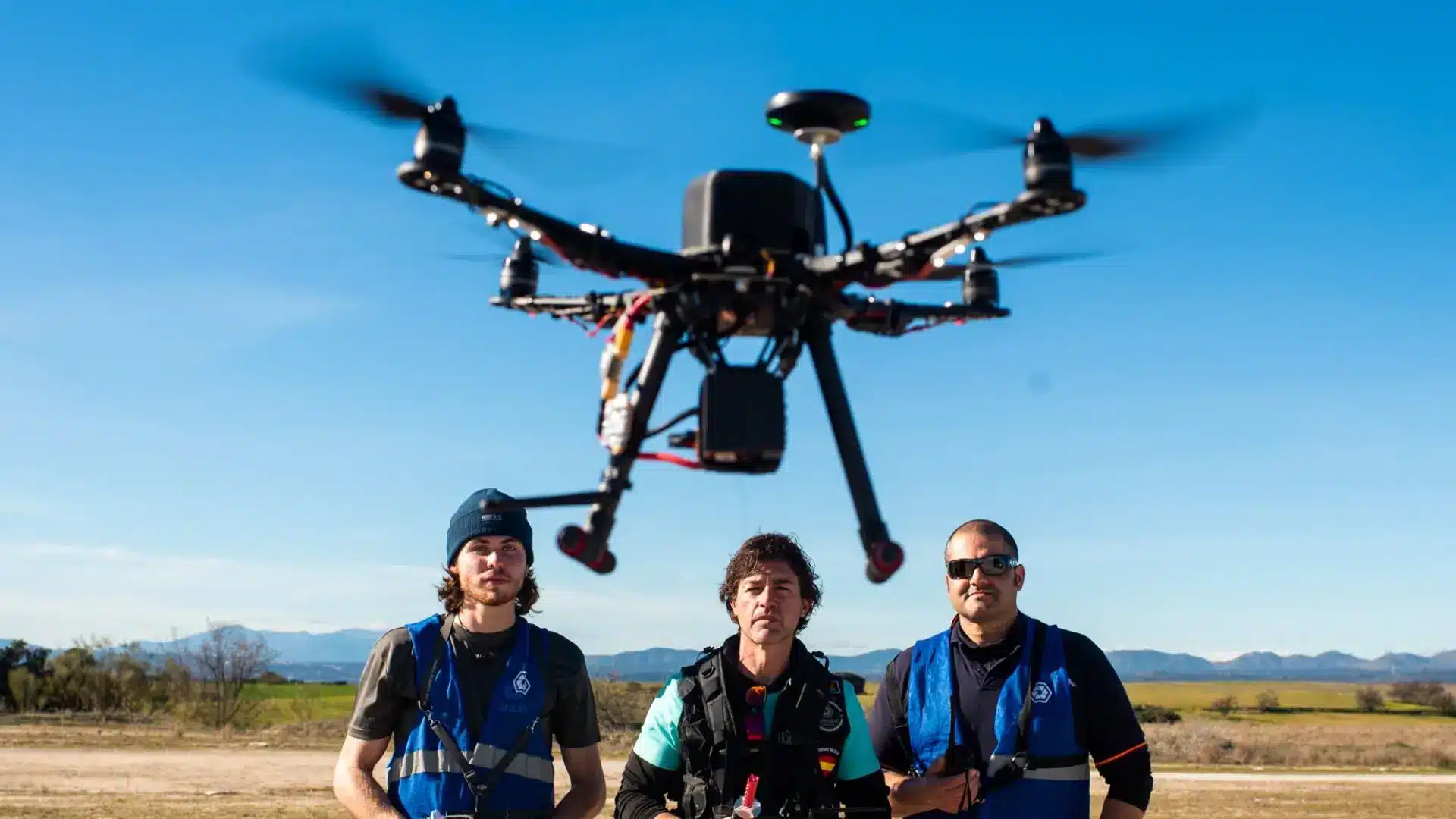
What does a drone need to do photogrammetry?
As we told you in the article on how to fly drones, there are many types of drones. From those specialised in drone shows, to others that are used specifically for photogrammetry. To perform work in this field, they must meet at least some minimum criteria:
- It must have a high quality camera, as the result of the plan that we deliver to the end customer will depend on it.
- The drone must have long-lasting batteries, as the flight can last for several hours.
- For some particular cases it will be necessary to have some additional accessories such as a night light, thermal camera or other accessories.
How to do photogrammetry with drones?
In order to perform photogrammetry with drones in Spain you must take into account the following stages of photogrammetric work; but it is important to note that you will also need to have experience and knowledge through the completion of some of the specific drone courses for this task.
At UMILES University we have the drone photogrammetry course so that you can understand each of the stages involved in the process.
Preparatory stage
First, the specialists consider the documentation of the initial permit for a building or structure, study the characteristics of its planning, architectural and design solutions, collect information about the territory and surrounding buildings, as well as assess accessibility for aerial photography.
Working stage
In this stage, automatic drone flight paths are planned and developed. The object is then filmed according to a pre-planned mission.
Photogrammetry stage
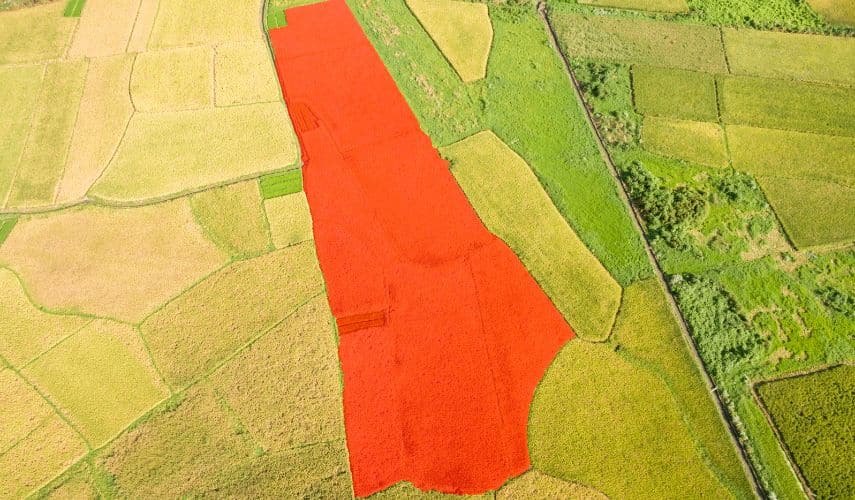
This is when image post-processing occurs, the correction of basic parameters to achieve maximum photographic quality, as well as alignment, triangulation and joining of photographs into a point cloud or the creation of a 3D model.
Analysis stage
When measuring, the actual dimensions of the building are applied to the orthophoto-map. If fault detection is carried out, the model and the orthophoto are carefully analysed from different angles. Based on this, a defect list is formed containing information about all damages in the form of symbols and markings. Due to the maximum precision of the results (up to 1 mm/pixel), all existing defect parameters can be examined in detail.
What are the types of photogrammetry?
There are mainly 2 types of photogrammetry: terrestrial and aerial. As you can imagine, the former is done directly from the ground and the latter from the air. Let’s take a look at the
- Aerial photogrammetry: as its name suggests, this is the technique that involves taking photographs from the air using aircraft or drones equipped with special cameras.
- Terrestrial photogrammetry: unlike aerial photogrammetry, terrestrial photogrammetry does not require aircraft of any kind. It is done by taking photographs from the ground using traditional cameras or laser scanners.
- Underwater photogrammetry: this is used when surveying oil stations or investigating the seabed and involves taking photographs from underwater using small submarines and divers with special cameras and lighting equipment.
- Space photogrammetry is very similar to aerial photogrammetry but the photographs are taken from orbiting satellites rather than from aircraft or drones. It is used for mapping and surveying the Earth.
- Mobile photogrammetry: finally, this type of photogrammetry is used in the inspection of roads and other types of civil constructions and is based on taking photographs from a moving vehicle, such as a car or train, using special cameras with sensors adapted for movement and position sensors to make measurements.
Advantages of photogrammetry with drones
One of the most important benefits of drone mapping can be considered the significant time savings. In a much shorter period of time, surveyors using unmanned aerial vehicles (UAS) perform a much larger amount of work than their counterparts working with traditional methods.
In other words, the amount of photography or filming that traditionally took a week or even longer, a team with drones could do in 1 day. And reduce the work time while maintaining high quality, which is accompanied by significant budget savings.
The speed and flexibility of deploying drones, along with supporting equipment, allows them to be used in a wide variety of locations. This is extremely important, as it eliminates the need to send an inspection team into dangerous areas, such as areas with difficult terrain, heavy traffic or unstable ground and steep embankments. Even mobile phone towers and tree tops are no longer an insurmountable obstacle if the work is done with the help of drones.
But that’s not all, it is also important to list the following advantages:
- Availability of precise positioning systems.
- Inspection and flight automation technologies.
- Extensive possibilities for installing additional equipment.
- Ability to work in adverse weather conditions.
- Availability of intelligent piloting systems.
- Compact and rapidly deployable tools.
Applications for photogrammetry with drones
The use of photogrammetric mapping has enabled the creation of many products using aerial photographs. These products include:
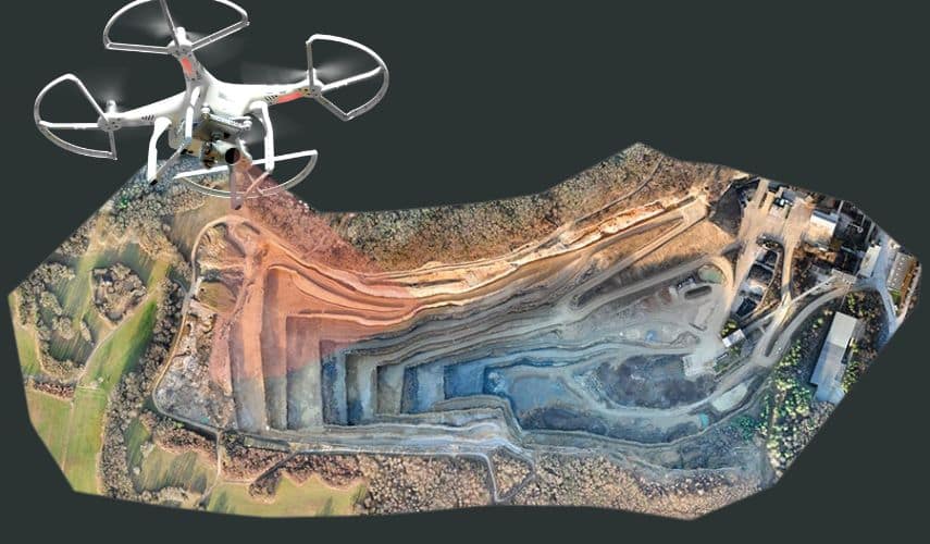
- DEM / DTM / DSM technologies (for surface and object modelling).
- Orthophotography (aerial images with geospatial correction).
- 3D models of buildings and objects.
- Contour maps.
- Obtaining planimetric features (roadsides, hills, objects, built-up areas, etc.).
3D images of objects are successfully used to implement projects. Savings are also achieved as a result of improved measurement efficiency and reduced costs compared to aircraft.
Thanks to these advantages, the main applications of photogrammetric mapping are the following:
- Forestry management and planning.
- Flood modelling.
- Pollution modelling.
- Topographic surveying and mapping.
- Urban design.
- Transport planning.
- Oil and gas exploration.
- Quarrying and mining (parameter calculation and exploration).
- Archeology
- Cellular network design.