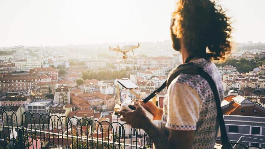
If you’re a drone video and aerial photography enthusiast, it’s essential that you have a drone equipped with a 4K camera to capture high-quality footage from above.
In this article, we’ll introduce you to the best professional 4K camera drones of 2023. You will find out which drone is good for videos and which ones are ideal for high-quality photography.
At UMILES University we give you the opportunity to specialise with our Audiovisual Drone Pilot Course, so that you can make incredible films with drones like the ones we are going to detail below. But if you want to go further, we recommend you to get information about our PROFESSIONAL DRONE PILOT COURSE.
What does 4K mean in a drone?
The term “4K” in relation to drones refers to the resolution of the camera. 4K resolution means that the camera is capable of capturing images with a resolution of at least 3840 x 2160 pixels, which provides exceptional clarity and fine detail in videos.
This translates into sharper images and vibrant colours, which is ideal for high-quality aerial photography and videos.
TOP 5: the best 4k drones
There are several features that can tell you which drone is good for photos and videos, including a high-quality camera and additional elements that improve the stability and smoothness of the footage. Here’s a list of the best drones with professional 4K cameras that stand out in this category:
DJI Mavic Air 2
This drone is an excellent choice for videos thanks to its high-resolution 5.4K camera and advanced stabilisation. The DJI Mavic Air 2 features a 1″ image sensor, capable of capturing images with large 2.4 μm pixels, so you can appreciate even the smallest detail. This is a typical feature of larger, heavier drones, but in this case the DJI Mavic Air 2 weighs less than 600g, so you’ll be able to fly at altitude without much hassle.
It also has intelligent flight modes that allow you to capture cinematic shots with ease and precision.
DJI Mavic 3
The DJI Mavic 3 is a professional-grade drone ideal for capturing video, offering exceptional image quality thanks to its 5.1K camera. Equipped with features such as autofocus and object tracking for impressive results, it is also one of the best drones with a follow me function.
In addition, it has a night mode function, which has been optimised for perfect filming when flying the drone at night.
DJI Inspire 3
If you are looking for a more advanced and versatile option for working as a drone pilot specialising in audiovisuals, the DJI Inspire 3 is an excellent choice.
It’s a professional drone designed for use by professional filmmakers who need to shoot complex aerial footage. It is not a 4k drone, as it has a full-frame 8K camera, and a superior stabilisation system, allowing you to get smooth and sharp videos even in challenging conditions.
It features DJI’s latest image processing system, which enables video recordings at up to 8K/75 fps. In addition, it is equipped with more than 14 dynamic steps for recording in low-light scenarios, delivering the highest quality professional results.
Autel EVO II Pro
This drone offers exceptional image quality thanks to its 1-inch sensor, its high resolution of 20 megapixels and the ability to record videos in 6K resolution. These features allow you to capture detailed, sharp and professional images from an impressive aerial perspective.
DJI Mavic Mini 3
If you’re looking for a mini drone with a 4K camera, the Mavic Mini 3 is an excellent compact but powerful option. Despite its small size, it’s an excellent drone with a 4K camera and GPS for video recording, allowing you to capture sharp images with true colours no matter what time of day it is.
This is one of the cheap, quality 4K camera drones you can find on the market if you want to get started in the professional video recording worldwith this type of device, as it will allow you to do professional work without investing too much.
Now that you know the characteristics of these 5 professional drones, you can choose the most suitable one for your needs. Which one do you choose?
Geofencing is very important in terms of the safety and drone flight control, as it allows all operators to identify the areas in which they can fly a drone without breaching current EASA regulations, and thus prevent them from incurring fines unnecessarily. That is why we explain in detail below everything related to geo-fencing in drones.
What is Geofencing in drones?
Drone geofencing is a system that uses GPS technology to establish virtual geographical boundaries, known as geofences, within which drones can operate.
These are defined as permitted or restricted areas for drone flight, the main purpose of which is to ensure safety, privacy and compliance with air traffic regulations in Europe when flying drones. If you want specific information on restrictions for flying drones, here are some articles from our blog:
The term “AirTag” refers to a tracking and tracing device to help users find lost objects, such as keys, wallets or backpacks. In the case of drones, such tags can be used to detect the drone’s location in real time.
How does Geofencing in drones work?
Geofencing in drones is based on GPS technology to determine the precise location of the drone in real time, which works as follows:
Boundary definition:The drone operator or manufacturer sets virtual geographic boundaries in a specialised software or application, so that the drone can identify permitted areas (safe and legal) or restricted areas (prohibited areas or areas subject to specific restrictions).
Receiving the drone’s location: The drone uses its GPS receiver to determine its precise geographic location.
Comparison of location with boundaries:The software or application continuously compares the drone’s current location with the defined geographical boundaries.
Predefined drone responses:When the drone crosses the geofence boundaries, it can be instructed to stop, change direction, land or take other actions according to the set configuration.
Components of a geofence:
A geofence consists of the following components:
Geographic reference points:These are the points that define the boundaries of the geofence, which can be specific GPS coordinates or predefined areas in the software.
Software or application:This is used to set and configure the geographic boundaries, as well as to manage the drone’s responses when geofencing is activated.
Types of geofences:
There are different types of geofences that can be set up for drones:
Circular (static) geofences: These are shaped like a circle and are defined around a central point. They are useful for establishing exclusion areas or areas of safe operation around a specific location.
Polygonal (dynamic) Geofences: These are polygon-shaped and are defined by a series of reference points. They are useful for delimiting more complex areas, such as airports, parks or public events.
What are the advantages of geofences on drones?
The use of geofences on drones offers several advantages, as they facilitate the use of drones by operators, including the following:
Safety:Geofences help prevent drones from entering dangerous areas or restrict access to sensitive areas, such as airports or restricted airspaces (SPAs, SACs and SCIs).
Regulatory compliance:These facilitate compliance with regulations and restrictions set by civil aviation authorities. Therefore, this helps drone operators to fly within legal limits and avoid unintentional infringements.
Privacy protection:They can be used to protect people’s privacy by preventing drones from flying over residential areas or private property without consent.
Accident prevention: By establishing exclusion areas around obstacles or structures, geofences help prevent collisions and reduce the risk of accidents during flight.
What kind of frequencies do drones use?
Drones use a variety of frequencies for different functions and communications during their operation. These include the following:
Remote control frequency: These allow you to transmit flight instructions, set the direction, altitude and flight mode of the drone. Radio frequencies are usually used for communication between the remote control and the drone (2.4 GHz and 5.8 GHz).
Video transmission frequency:Many drones are equipped with cameras and transmit real-time video to the remote control or other receiving devices. For this, different frequencies are used depending on the model and device.
GPS navigation frequency:For positioning and navigation, drones use the GPS signal frequency, which is based on 1.2 GHz and 1.6 GHz satellite signals.
In relation to geofencing, drones use the frequency of communication with the GPS navigation system. The drones receive signals from the satellites that allow them to determine their precise location, and thus avoid overstepping previously established lines.
Now that you know how a drone’s GPS works, and its respective limitations through geofencing, it’s time for you to get certified as an expert operator through our professional drone pilot course, where we will give you everything you need to start working in this highly competitive field of work.
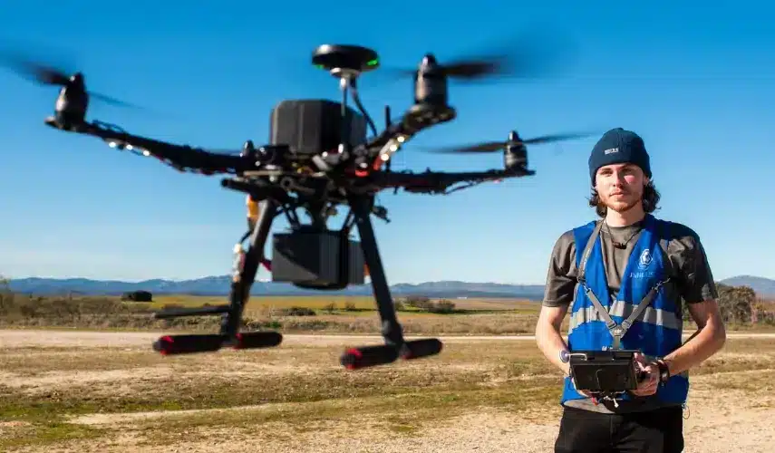
If you’ve just bought a drone, or are thinking about getting one, you’re probably eager to get up and running with your new acquisition and master the air. But keep in mind that controlling this type of aerial vehicle can be a difficult task at first, so take the time to learn how to fly a drone safely and avoid accidents.
In fact, if you really want to learn how to fly a drone so that you can take advantage of the professional opportunities that exist in this sector, we recommend you take any of our drone courses.
We have the most complete offer, ranging from advanced courses with which you get all the certifications such as the professional drone pilot course, to more specific training such as the radio operator course or the drone photogrammetry course. Therefore, if you want to learn how to fly a drone properly, we are your best option.
Tips that every beginner should know before learning how to fly a drone
Flying a drone for the first time can be a difficult task, which is why safety should be your first priority when learning how to fly drones. This is because as a flying object, it is possible to cause harm to yourself or others if you do not have good control of the device.
In addition, the drone can also be affected by strong impacts or falls. Therefore, before learning how to fly a drone, you should pay attention to safety measures and follow the recommendations below.
Know the safety rules before learning how to fly a drone
You must know that European drone regulations have established certain safety rules that every drone owner must follow when learning how to fly drones. As this legislation can change from time to time, we recommend that you always read the current regulations. Some of the rules are:
The maximum flight altitude allowed is 120 metres.
The pilot must always maintain visual contact with the drone.
You may not fly near airports
Special authorisations are required to fly in controlled areas such as SPAs.
Select an inexpensive drone
If you don’t know how to operate a drone yet, it is almost impossible to avoid that your drone suffers some bumps or falls due to lack of experience, which can seriously affect the parts of the drone. That is why it is best for all beginners to choose an inexpensive and simple drone, so that if situations arise in which the drone is badly affected, you will not lose a lot of money.
Once you have mastered all the techniques and know how to fly a drone properly, then it will be the right time to buy a newer model with many more features.
Choose the right place to practice
If you don’t have any experience with drone flying, it is best to choose an open, obstacle-free place where you can start your first tests.
Keep in mind that there is a high probability that your drone will fall or that you will lose control due to lack of experience, so you should avoid accidents. In this post we talk about where to fly drones, but we recommend you always go to the official ENAIRE source.
You should never start your practice in areas where there are people or animals around, as you could hit them and cause them problems if you don’t know how to control a drone.
In addition, you should take into account the weather, to avoid exposing the drone to strong wind currents that interfere with its flight when you are inexperienced and just learning how to fly a drone.
Familiarise yourself with the controls
Although there are many types of drones and some have specific functions, the basic ones are controlled by a remote control consisting of two joysticks, which allow you to control the various movements of the drone.
In general, all remote controllers used to control the drone have two modes of configuration. The most commonly used is “Mode 2”, which generally (not in all models but in most), each joystick has the following functions:
The right joystick controls horizontal movements, to the right and left, or forward and backward.
The left joystick controls turning and vertical movements. It is also responsible for acceleration.
Right stick
When you move the right stick in any of the allowed directions, the drone will move in the same direction, as long as you are behind the drone. That is, if you move the stick to the right, the drone will move to the right and likewise to the left. If you move the joystick forward, the drone will move to the right, and if you move the joystick towards your body, the drone will move backwards.
Note that when the drone changes direction and faces you, the controls are reversed, so you should always turn in the direction the drone is moving in order to have better control of the drone.
Left stick
The left stick will accelerate the motors so that the movement of the blades helps to lift the drone.
Moving the left stick forward will accelerate the drone, while moving it backwards will decelerate it. Moving the lever to the right will turn the drone clockwise, and to the left it will turn the drone counter-clockwise. Once you have mastered these 2 levers, you will know how to fly a drone in a basic way.
Once you have mastered both levers you will know how to lift a drone in any situation, but remember that to achieve excellence you need a lot of practice.
Other button
Depending on the drone model you have selected, the controller will have additional buttons that activate certain functions. One of the most common is the auto-level function, which will help you keep the drone’s camera aligned with the horizon for better quality images.
It may also have buttons to activate the auto return function, image capture, video recording, among other functions.
In any case, it is best to read the user manual of your drone so that you can learn the functions of each of the buttons included.
Perform small tests before flying your drone
To learn how to fly a drone, you should perform minimal elevation tests to familiarise yourself with the movements and sensitivity of the controls.
It is recommended that you start with small tests where you constantly repeat various movements until you have mastered them. You can use these practice exercises:
Raise the drone gently, no more than 30cm from the ground. This will allow you to know how much pressure to apply to the joystick so that it can separate from the ground, and let it drop slightly. This movement will be ideal for you to learn how to land a drone without hitting it hard when it falls.
Once you have mastered the elevation, you will need to do small test movements. Try flying the drone in straight lines until it forms a square. This will help you master horizontal movements.
Mark two points on the ground and try to move the drone from the first to the second point so that you can control the distances.
Try to lift the drone and keep it in one place. This may seem like a simple task, but when you try it, you will see that it is not so easy.
At this stage you will have to be very patient and practice each movement several times until you have mastered the drone. Remember that it is practice that will give you enough skill to know how to fly a drone like an expert.
Note: Some models have a simulator that allows you to experience the control of the drone virtually, so that you can familiarise yourself with the movements before you go into the real world.
Check that you have everything you need before learning how to fly a drone
Read the manufacturer’s manual so that you can apply all the necessary settings according to the drone model you have purchased.
Usually all the pre-settings are set by the manufacturer, but in some cases it will be necessary to apply checks on the calibration of the drone, GPS or compass to ensure a correct flying experience.
Once you know how to fly mini drones, you should always do a small check before each flight to make sure you have everything you need:
Check that the battery level is at 100%. It is always better to have the full potential of the batteries to be able to use it for longer without interruption.
Always carry a set of replacement batteries with you in case the batteries installed in the drone run out. You should also check that the batteries are charged.
Check that the memory card is inserted. If your drone has a camera, it is very common to fly the drone thinking you are recording the landscape, only to realise that nothing has been recorded because the card is missing.
Before turning the drone on you should check that the throttle is at its minimum setting.
If the drone needs to be calibrated with the satellite, you should wait until the configuration is complete before starting the flight.
Check that the space in which you are flying the drone has sufficient free area and identify any obstacles that could interfere with communication with the controller.
If your drone has an auto-return function, you should check that its flight altitude is higher than the obstacles that could get in the way.
How to fly a drone for the first time?
In order to learn how to use a drone for the first time, it is important that you learn to master three basic movements that are fundamental during any type of flight: take-off, hovering in the air and landing.
Here are some instructions on how to fly a drone, which will allow you to master the basics of flying a drone.
How to take off a drone?
One of the main activities to learn how to fly a drone correctly is take-off. Controlling how to take off a drone is not an easy task.
Each drone may operate differently, so we recommend that you read the drone manual carefully. However, in order for the drone to take off, it is usually only necessary to use the throttle:
Position the drone at the take-off point, making sure there are no objects or people nearby.
Position yourself behind the drone and back up a few steps to be at a safe distance in case the take-off goes wrong.
Before starting the drone, check that the throttle lever is at its starting point.
Turn the drone on and gently press the left joystick forward (throttle) and stop. This will spin the blades, but it will not yet lift off.
Press the left joystick forward a little more until you feel the drone start to separate from the ground.
Don’t let it rise more than 30cm off the ground, and slowly ease the throttle back. This will bring the drone back into contact with the ground and you can practise a few times until you feel confident to lift it a little higher.
How do I get my drone to hover?
Keeping the drone in the air takes a bit of practice, as you need to get it off the ground and then maintain a constant speed. Make a few small adjustments with the right stick and you should be able to get the drone to hover.
How to land a drone?
Knowing how to fly a drone is not all you need to know, another critical action that every beginner must learn is how to land the drone. This is fundamental to prevent the aerial vehicle from colliding with the ground and damaging itself. In this case the technique is quite simple:
Once the drone is in the air, you must position it at a point where it can descend without hitting an object.
To land it is necessary to gently roll back the throttle so that the drone slowly approaches the ground.
When the drone is about 3-5 cm above the ground before it touches the ground, then you should bring the throttle back to 0 so that it finishes descending.
Once you have mastered landing the drone correctly, you can consider that you know the basics of how to operate a drone. Therefore, you can put your skills into practice whenever you wish, as long as you comply with the requirements and regulations of the country you are in.
Do you need a licence to fly a drone?
Now you know how to fly a drone, but did you know that European legislation requires you to have a drone licence if your drone weighs more than 250 grams?
For the use of drones weighing less than 250 grams, it is only necessary to familiarise yourself with the manufacturer’s user manual. However, in any case, the flight regulations established for the use of drones in Spanish airspace must be complied with.
Likewise, it is ideal to have civil liability insurance for drones in case the drone hits a person or other objects and it is necessary to cover damages caused to third parties. Although it is not a compulsory document.
We hope you found this guide on how to fly a drone useful. If so, share it with your friends and let other people know about this wonderful aerial world.
How difficult is it to fly a drone?
Once you know the basics of how to fly drones, it will become easier and easier to master the other movements. You just need to practice frequently so that you can perfect your technique.
If you follow all the steps for flying a drone for the first time that we have given you at UMILES, you can become a professional in no time.
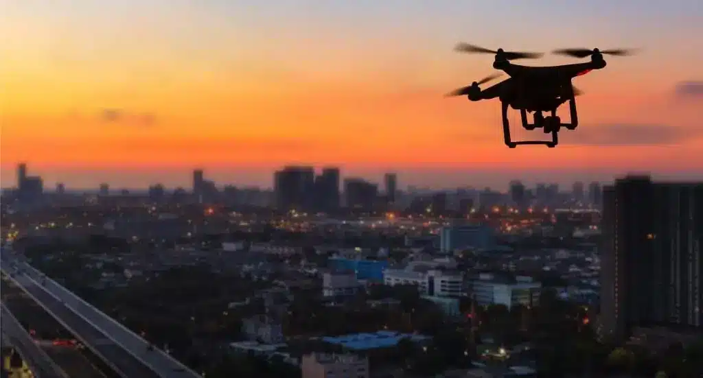
In Spain, until the entry into force of the European regulation, drones could only be flown in the city if the operation was recreational, with the limitation of flying up to 20 metres in height. If the operation was professional, it was only possible to fly over agglomerations of buildings or inhabited places with an Operational Authorisation issued by AESA for city flights. This was indicated in Royal Decree 1036/2017, which regulated the drone sector in Spain until the end of 2020.
However, with the entry into force of the European UAS Regulations in 2021, flight in urban environments was liberalised, and the current regulations allow drones to be flown in the city, both in the open and specific categories.
Although it is important to note that even though you can use a drone in the city, there are some limitations that you must take into account to avoid breaching the current drone regulations in Spain.
WHAT SHOULD I TAKE INTO ACCOUNT TO FLY MY DRONE IN A CITY?
First,you should know the regulations that allow you to fly drones in Spain and Europe, and for this we recommend that you consult theAESA websitewhere you can check everything you need to have before flying your drone, such as registration as an operator, training through adrone pilot course and civil liability insurance for drones.
Just because the regulations allow flying in cities does not mean that flying in these types of locations is exactly the same outside an urban environment, as in the case of SPA areas, where there may be special limitations and a drone licence or a drone pilot’s licence may be required.
Important aspects to consider before starting to fly with drones
It is important to prepare the operation with your drone and check the area on different maps (ENAIRE Drones, Google Maps, Google Earth). This can help you understand the geography of the terrain and the obstacles you may encounter on the day of your flight. In addition, you should check that you comply with all permits to fly drones in the specific city, as there may be limitations due to proximity to airports or areas with regulations.
In addition, your aircraft must also be qualified for city flying. For example, it is mandatory to equip your drone with an impact energy limitation system. It is important to know that a parachute or similar system is mandatory to carry when, according to the regulation: “the impact energy of your aircraft exceeds 80J”. This measure, the Joules of Energy, implies a scale of possible damage that your drone could cause when it falls on someone. In other words, not all aircraft have the same impact energy. And it is not an easy figure to calculate. It is a figure that can be provided by the manufacturer, or that you can find in the list of aircraft that AESA has in the application where you must register as a drone operator when you register your aircraft. It is not because your aircraft weighs more that it will have more impact energy. It may have a much larger wingspan and this may reduce this energy.
Apart from the regulatory obligations and the preparation of the flight in map tools, it is very important to be aware that flying in urban areas requires certain permits and requirements.
Drone legislation in Spain
With the entry into force of Implementing Regulation (EU) 2019/947, the use of identification plates for drones is mandatory in almost any scenario. On the other hand, if the activity is recreational, you can fly up to 20m with a drone of less than 250gr. But this does not exempt you from applying for other necessary permits, such as coordination with heliports, for example.
In addition, if you occupy public roads or fly over urban areas, you should check with the local council about any limitations.
On the other hand, depending on the Operational Category in which you are going to fly your drone, you will have to maintain a series of distances and rules:
Open A1: This category allows drones up to 500g to be flown during transition (before mandatory European Class labelling). Flying drones of this size will require you to avoid overflying by outsiders as much as possible and under no circumstances will you be allowed to fly over crowds of people.
Open A2: This category allows drones up to 2kg to be flown during transition (before mandatory European Class labelling). Flying drones of this size will require you to keep 50m horizontally clear of outsiders.
STS-ES-01: applying the standard scenario developed for flying drones weighing up to 10kg in an urban environment, these aircraft will be allowed to fly but you must comply with all the requirements specified in the Scenario.
It is important to take into account the application for the necessary permits depending on the area of operation. In building agglomerations, you should always apply for a Communication to the Ministry of the Interior, among others.
Even so, you should train well for a flight in a city. The air currents, the curiosity you may generate among people nearby and the complexity of a city (vehicles, little space, buildings, interference with GPS and other signals) can make things difficult for you.
Fly carefully, always check the regulations with the Authorities (AESA, police…), and keep up to date with our news so that you know the different types of drones and all the information related to UAS in Spain.
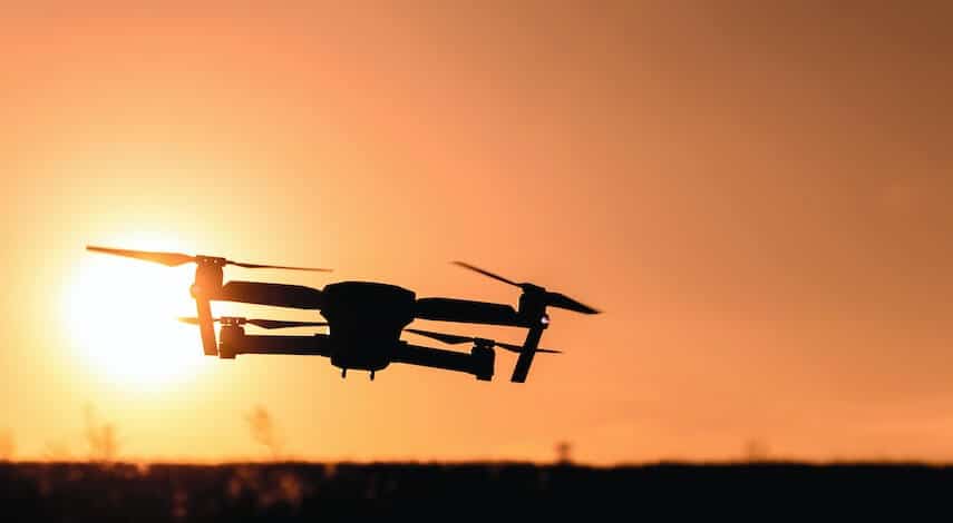
Can a drone be flown at night in the city?
As with drone flights during the day, it is permitted to fly drones at night, as long as they comply with the conditions required for this type of operation.
To fly drones at night it is necessary for the pilot to be an expert and to have undergone intensive training in night operations. This is because this type of activity is more complex. In addition, the drone must be equipped with regulatory lights that allow its location to be easily detected.
In the case of light shows with drones for events, it will be necessary to obtain some additional permits according to the regulations of each locality.
Can a drone be flown in a village?
Yes, it is generally possible to fly a drone in a town as long as certain regulations and considerations are respected. Although regulations may vary from place to place, it is important to follow the general guidelines set out to fly drones safely and legally.
So, as with flying a drone in a city, you should check that the area has no restrictions and that you meet all the requirements to be a drone pilot. It is also important that you document yourself about drone regulations at airports, in case your town is less than 8 kilometres away from an airport.
Drones have become an important part of the tasks we carry out in various fields of activity. That is why it is increasingly common to see this type of “flying vehicles” among us. But do you really know what a drone is?
It is important to know the characteristics of this type of unmanned aircraft and to understand what drones are for, so that you can take advantage of all the functions they have.
If you want to know what a drone is and what it is used for, you can’t miss this article in which we explain in detail everything related to drones: operation, types and uses. In this way, you will be able to learn from all the information about drones that we have to offer you at UMILES.
What is a drone?
Before knowing what drones are and what they are used for, it is important to know what these aircraft are commonly known as. The definition of drones can be very broad, as different terms are often used to encompass these devices.
A drone is an unmanned aerial vehicle, meaning that is a type of aircraft that is capable of moving through the air without a pilot on board. They can be controlled remotely, or by specific programming using software and GPS to operate autonomously.
This is only one definition of a drone, although they are also known as UAVs or RPAs. For this reason, it is necessary to differentiate between the characteristics that distinguish these types of drones according to their acronyms.
What is an RPA?
As mentioned above, there are different modes of drone operation. The most common are RPAs (Remotely Piloted Aircraft), which are remotely operated drones, and are literally defined as remotely piloted aircraft.
Therefore, all those drones that can be configured and have the autonomy to operate without the direct control of a remote pilot are excluded from this type of variety. Remember that you have an article to learn more about the meaning of RPA.
How does a drone work?
Drones work by means of a set of electric motors that propel the device through a multi-propeller system that provides great stability when taking off, flying and landing.
They usually have long battery life, so they are able to stay in the air for quite a long time before requiring a battery change or recharge. So they are very useful for a variety of uses.
In the case of RPAs, they are operated from a remote ground station via a communications link, which sends signals to the drone to perform the manoeuvres the pilot wants it to perform.
On the other hand, those that are not remotely controlled are linked to software that uses GPS to programme controlled flights, and these operate autonomously. In this variety are drones used for agriculture, which are usually programmed to perform various tasks on crops (see drone precision farming course).
Some of them have multiple sensors that allow them to detect obstacles on the route, capture images, make drone filming or additional accessories, such as lights that allow drones to fly at night, so that their specific operation varies depending on the characteristics of the drone.
What is a drone used for?
If you are one of those people who wonders: what are drones used for? You will be surprised to know that there are many applications that have been given to this type of aerial vehicles nowadays. In fact, there are so many functions of a drone that more and more uses are being found every day to improve the way in which various activities are carried out.
Below we detail the functions of drones in general and the main uses of professional drones, as well as those used for recreational purposes.
1. Drones for Cinematographic Filming
One of the main uses for a drone is in the cinematographic field, to capture scenes from the air, with a view to all angles, without any interference and with very little consumption of resources.
Drones for filmmaking facilitate the aerial filming process, as it avoids the need to use helicopters or any type of crane to capture images at altitude. Now, just by adapting a powerful system of cameras and lenses, professional quality images can be obtained in a short time. At UMILES GROUP we are specialists in aerial filming with drones for TV, cinema and advertising with our drone filming division.
2. What is the use of drones in agriculture?
In agriculture, different processes have been optimised by automating them through the use of technology. Therefore, it is common to see drones being used for spraying or crop irrigation, which streamline the process and optimise resources. Therefore, this is another of the uses for which the drone serves as the main working element.
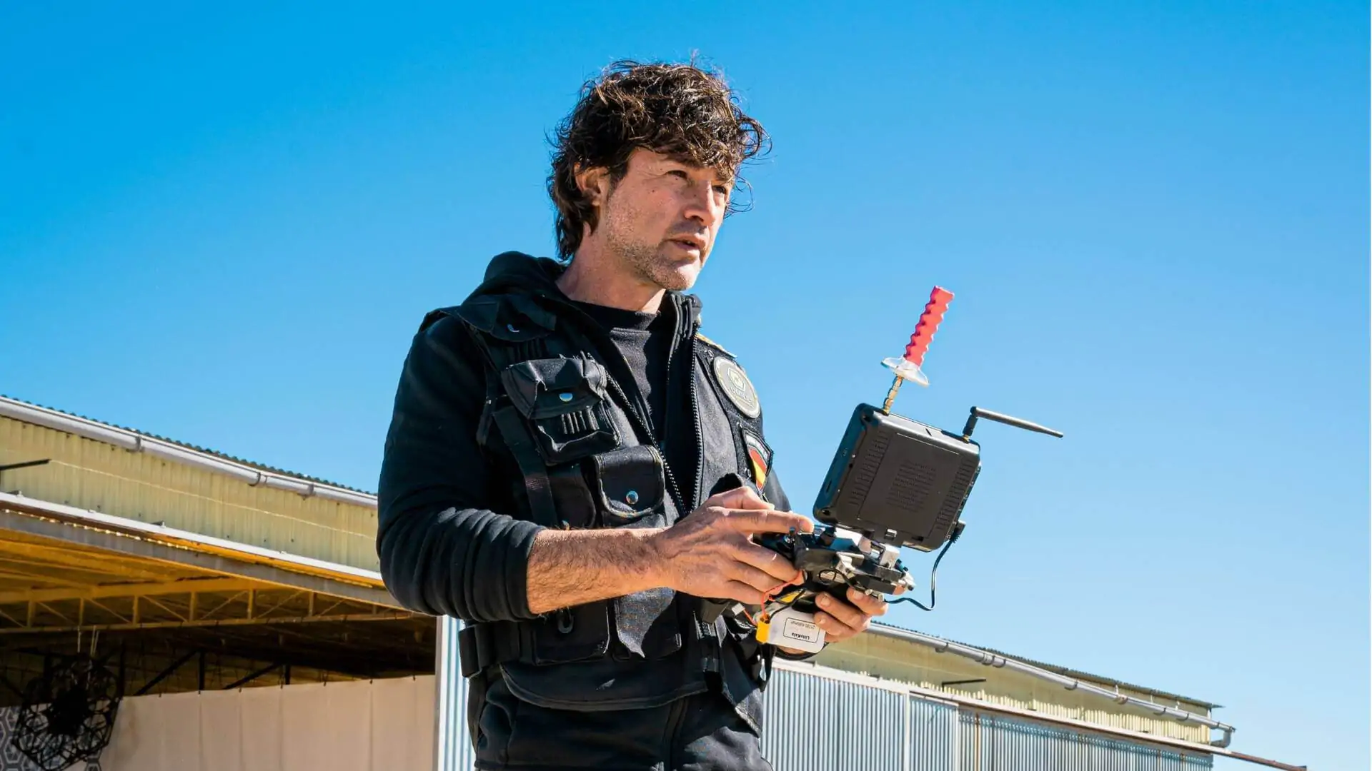
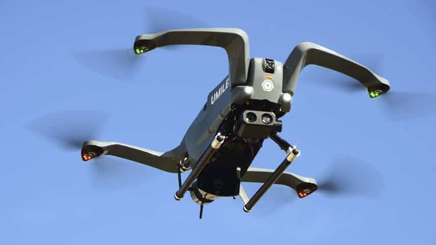
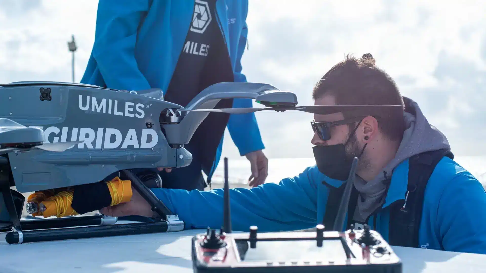
3. What is a security drone used for?
Drones are also especially useful for thecontrol and monitoring of airspace. Their portability and autonomy allow them to be used for the exploration of areas that are inaccessible from a human perspective.
4. What do entertainment drones do?
One of the most striking applications of drones today is their use for mass entertainment through light shows. This type of drone shows are becoming more and more fashionable and you can hire them through our Drone Light Show division that we offer at UMILES. Without a doubt, it is an excellent alternative for celebrations or special event promotions.
They can be used as a substitute for fireworks shows, which are usually very polluting. So they are an excellent entertainment alternative, offering a unique and unparalleled experience.
5. Fire and disaster control
Some professional drones are equipped with powerful systems that allow them to carry heavy payloads to help fight fires and forest disasters. These help to provide rapid access to the affected area, without putting the pilot’s life at risk.A
6. Cargo transport
Depending on the characteristics of a drone, special uses can be applied that enhance the wide-ranging benefits of these devices.
One of the most recent uses, but one that is gaining momentum, is logistics and transport drones, which are used to deliver packages and goods. Although this activity is not yet regulated in Spain, in other countries they are used as an alternative to sales businesses with delivery services to make quick and efficient deliveries.
7. Recreational drones
Finally, one of the most popular uses of drones is recreational. This refers to those who wish to fly a drone only as a hobby and do not perform any specific activity during the flight.
Parts of a drone
Drones are made up of several fundamental parts that contribute to their operation. From the motors and propellers that generate the propulsive force, to the sensors and control systems that enable stability and precise navigation.
If you would like more detailed information about the different parts of a drone and how each one contributes to its successful flight, we invite you to read our drone parts article. There you will find answers to all your questions related to this topic.
Drone characteristics according to their use
At this point you should be clear about what a drone is and what it is used for, but you may still be unclear about the characteristics of these aircraft. There are many ways to distinguish the types of drones, but in a general sense we can classify drones according to their characteristics of use:
Personal drones
Professional drones
Cargo drones
Passenger drones
Personal drones
Personal drones are usually the simplest drones, as they have no specific requirements. They can be used solely for the purpose of the flying experience, so they have no additional elements.
Many models usually have a camera for simple aerial photography and filming, allowing the user to observe their surroundings from a different point of view.
Features of a professional drone
Professional drones are usually larger or have more parts to perform a specific activity. These drones are used to perform multiple types of activities, and there are more and more tasks that a professional drone can be used for.
Some of the elements that characterise professional drones are high definition cameras, stabilisers, proximity sensors, among many others.
Characteristics of passenger drones
The characteristics of a passenger drone are different from most UAS, as they are aircraft designed to hold a passenger and his or her luggage inside, with the capacity to rise and land vertically.
What are cargo drones like?
The main function of the cargo drone is to transport items from one place to another, so its main feature is a winch that is placed on the body of the drone to lift loads of different weights.
Now that you know what a drone is and what it is used for, it is time for you to take the decision to try your skills with the use of this type of unmanned aircraft. All you have to do is contact our team at UMILES Group to find out about all the services we offer you.
And if you want to become a qualified professional and certified by AESA to work in one of the sectors with more labour demand at the moment, we recommend our professional drone pilot course.
5 characteristics of a cargo drone
The characteristics ofcargo dronescan vary depending on the model and brand, but five common characteristics they usually have are:
Payload capacity: These types of drones are designed to carry heavy payloads. Therefore, a key feature is their payload capacity, which can vary from a few to hundreds of kilograms, depending on their size.
Flying range: To fulfil their cargo carrying purpose, they must have high-capacity drone batteries or even hybrid propulsion systems.
Advanced navigation systems: These drones need sophisticated navigation systems to fly autonomously and safely.
Stability and endurance: Due to the heavy loads they carry, these drones need to be stable and sturdy.
Communication and connectivity: Cargo drones often require reliable communication and connectivity for their operation. This may involve the ability to connect to mobile networks, satellite networks or remote control systems.
You probably already knowwhat a drone is and what it is used for, but… have you heard about other terms used to refer to these and other aircraft? In the field of drones, it is common to use different words to refer to these aircraft that are increasingly used for different applications. Therefore, terms such as UAS, UAV, RPA, and RPAS can be found when talking about drones as such.
However, it is important to make a distinction between each of them to avoid making incorrect references when talking about the different variations and systems that are used to control this type of aircraft, which are popularly known as drones.
RPA, RPAS, UAV and UAS, what are the differences?
Although these terms are often used indistinctly due to their similar meanings, it is necessary to highlight thedifferences between RPA, RPAS, UAV and UAS. Otherwise, confusion may arise when trying to understand information related to drones.
These differences are noticeable, as some of these terms are used to refer to aircraft as such; but others refer to complete systems that are put in place to fly a drone.
What is an RPA?
Es decir, un RPA es cualquier tipo de aeronave no tripulada, que es controlada de manera remota por un piloto a cierta distancia.
The term RPA comes from the phrase “Remotely Piloted Aircraft“. This characteristic is what mainly distinguishes these types of drones, since it is required to be an unmanned aircraft that is controlled from a remote station, unlike other drones that can be programmable and that execute their actions autonomously.
In other words, an RPA is any type of unmanned aircraft, which is controlled remotely by a pilot at a certain distance.
What does RPAS mean in drones?
The word RPAS can be related to a variation of the term RPA. However, it should be emphasized that it is a system and not a drone as such. The term RPAS comes from the phrase “Remotely Piloted Aircraft System”.
Therefore, the meaning of RPAS includes both the aircraft, the communications link and the ground station from which the drone is controlled. This means that you must have very clear what an RPAS is and not to confuse it with RPA if you want to work as a drone pilot after doing our drone pilot course.
We must also make a distinction between the terms RPAS and RPAs in drones, that even when they seem very similar, they do not refer to precisely the same thing. As we have previously pointed out, RPAS (with a capital ‘S’), refers to the system formed by the different elements that interfere in the flight of an RPA. While the term RPAs (with a lowercase ‘S’), is used as a way of referring to the drone or RPA in the plural sense.
What is a UAV?
The acronym UAV stands for any “Unmanned Aerial Vehicle” that is controlled by a pilot or by a computer program. Undoubtedly, it is one of the most common terms to refer to drones.
This is a more global term, which can be used to refer to the different varieties of drones, because it includes both programmable unmanned vehicles and RPAs. In other words, both remotely piloted and non-remote piloted aircraft can be included in the meaning of UAV. So it can be said that RPAs are UAVs, but not all UAVs are RPAs.
What is the meaning of UAS in drones?
It is important to understand what UAS means and how it differs from other terms.
Just as RPAS refers to the flight system of RPAs, UAS refers to the system used for the flight of an unmanned aerial vehicle; that is, the flight system of a UAV. So even though there is a relationship between the terms UAV and UAS, it cannot be said that they mean the same thing.
What are the acronyms UAS in drones?
The acronym comes from the phrase “Unmanned Aerial System“. And if you are wondering «What is UAS in aviation? », we can say that these acronyms mean exactly the same thing, both in the aircraft and drone sectors. In both cases, they refer to an unmanned aircraft and all its related elements that operate without having a pilot on board.
What are the differences between RPA UAV RPAS UAS and drones?
If you are still not clear about the difference between drone and UAV or any other of the terms, we invite you to read this short summary by way of conclusion, where we will summarize the main differences between all of them in a concrete way:
RPA: stands for “Remotely Piloted Aircraft” and refers to drones or aircraft that are operated by remote control by a human pilot from a remote location, rather than being manned by a person on board. In other words, a drone would be an RPA and a piloted commercial airliner would not.
UAV: stands for “Unmanned Aerial Vehicle” and refers to any of them that is controlled by a human pilot or by a computer with preconfigured commands.
RPAS: RPAS in drones stands for “Remotely Piloted Aircraft System” and refers to the complete system that makes up everything related to the unmanned aircraft. That is, it not only includes the UAV, but also the ground control system and the communication between both.
UAS: stands for “Unmanned Aircraft System” and is a more generic term that includes RPAS and UAV.
Drone: is a colloquial term often used when referring to any type of unmanned aircraft, be it an RPAS, UAV or any other type of system. The term drone is more frequently used, although its meaning is the same.
Remember that the main difference between RPA and RPAS is that the first term refers to a vehicle and the second to the complete system that allows to operate such vehicle. And you should not confuse the latter with UAS which stands for «Unmanned Aircraft System».
Now that you know the difference between RPA, RPAS, UAV and UAS, you can specialize in each of the branches of training that we have for you in UMILES with our drone courses. And if you are not yet registered in our courses, you can start by learning the differences between drone pilot and drone operator, which are other terms that are commonly confused among beginners in this exciting world of drone flight.
Remember that to perform flight operations with some of these UAVs, a drone license is required, so you should be prepared to meet the requirements of the AESA according to the current drone regulations in Spain.
Did you know that there are many types of drones? Whether it is because of the characteristics of their motorisation and arms, or because of the aspects of use thbecoming a professional pilot, it is important that you know what types of drones exist and what they are used for, so that you can get the most out of your unmanned aircraft.
at are covered by the regulations in force, there are many different types of drones today.
If you are interested inIn this article we will give you information on the types of drones according to their use, structure and number of propellers, as well as information on the categories of drones established in the European regulations governing all aerial activity related to unmanned aerial vehicles or UAS. This way, you will have the possibility to quickly identify the types of drones and their use.
But before continuing, if you want to train as a professional and access a job market with many opportunities and great salaries, we recommend you to take a look at our drone pilot course.
Types of drones according to their structure
Firstly, drones are classified according to their structure or shape, and two basic distinctions can be made:
Fixed-wing
Rotary-wing
Fixed-wing drones
Fixed-wing dronesare those that use aerodynamics for lift. They are similar in composition to aeroplanes, with an elongated body and wings, which emerge from the central main body, generating the lift force in the air.
The advantages of fixed-wing drones are that they are typically more energy efficient than rotary-wing drones, making them ideal for long-range and long duration flights.
Among their main uses, this category of drones is used for photogrammetry, precision agriculture and surveillance, among others. They are capable of covering large areas in a single flight and can be equipped with special cameras and sensors to collect data and generate high-resolution 3D maps and models.
Rotary wing drones
Among the types of UAVs, rotary wing drones or multi-rotors stand out. They are the most common in the current market due to their versatility, which achieve their lift by means of propellers driven by motors located on each of their arms.
Thanks to the characteristics of rotary wing drones, it is possible for these UAVs to stay in the air flying over the same point, and they have the ability to rise and land vertically, so they can be used in confined spaces if they have the right handling control.
These in turn are subdivided into different classes of drones, depending on the number of propellers or arms they have.
Types of drones by number of propellers or arms
One of the ways to identify the different types of drones that exist is according to the number of motors or arms that make up the drone. This is the most commonly used classification of drones, as it uses the appearance of the drone to differentiate between them, so it is easy to identify them.
They can be different sizes and have different functions, but their main characteristic is the number of arms they have and therefore the number of propellers. In this classification we can find 5 types of drones:
Tricopters
Quadcopters
Hexacopters
Octocopters
Coaxial
Tricopters
As the name suggests, this type of tricopter drone has 3 arms. In this case, each of the front arms has a motor that rotates in opposite directions to generate power. The rear motor acts as a servomotor to provide stability in flight.
Quadcopters
This is probably the most common type of drone on the market. It is an aerial vehicle with four arms, each of which has a motor. Thanks to their equidistant configuration they offer great stability.
Hexacopters
Hexacopters are drones with 6 arms and 6 engines. These are the most used in the professional field to achieve high quality aerial shots, thanks to their excellent stability, which allows cameras to be installed and professional level recordings to be made.
Another advantage of this type of drone is that they offer greater safety, since in case of failure of any of the engines, it is possible to land the drone without major problems only with the propulsion of the other engines.
Octocopters
As the name suggests, these drones have 8 arms and 8 motors. Their stabilisation capacity is even greater than that offered by haxacopters, however, they have the disadvantage that they are larger and heavier because they have more components. This is why they can be difficult to control in small spaces.
Coaxials
Another type of drones that can be found on the market are coaxial drones, which are drones thateach have 2 motors. Thanks to this feature they are much more powerful, so they can transport objects or rise to great heights more easily.
They are also widely used in the professional field, to take high quality aerial shots or to perform specific tasks that require the movement of objects. Without a doubt, the coaxial drone is one of the most versatile drones.
Drones categories by control method
Did you know that there are different ways to control a drone? Depending on how it is piloted, it can belong to one category or another. Let’s see which ones exist.
Autonomous drone
These are drones that do not need to have a pilot operating in real time to control the aircraft’s movements. That is to say, this type of drone moves autonomously according to a previous programming that guides it through the sites to be covered. It is widely used in agricultural drones.
Dron operated by remote control
As you can imagine, this kind of drone flies remotely controlled by a pilot. It is the most common type of drone and can be controlled by a remote control with a camera, or through FPV goggles that transmit images in real time and in first person to the pilot.
Classification according to AESA drone regulations
Another way in which drones are classified is based on current regulations. According to the current regulations issued by EASA (European Aviation Safety Agency), there are 6 classes of drones that are classified according to their maximum take-off mass or MTOW; but there are also a series of characteristics that the drone must meet in order to be considered within each category.
Among the drone categories set out in Regulations (EU) 2019/947 and (EU) 2019/945, classes ranging from C0 to C6 are listed. The last two classes have been incorporated in the Delegated Regulation (EU) 2020/1058 p, where these 2 have been included and will be the classes used in the European standard scenarios.
The requirements for each class of drones are listed below.
Class C0
The types of dC0 must comply with the following requirements:
Their maximum take-off weight or mass (MTOW) may not exceed 250g.
The flight speed must not exceed 19m/s.
They must be designed to avoid injury to persons and must be safely controllable.
They must be marketed with the manufacturer’s instructions for use.
Class C1
Drones falling into category C1 must comply with the following specifications:
Their weight or MTOW must be less than 900g, but greater than 250gr.
Their impact energy may not exceed 80 joules.
Their flight speed must not exceed 19 metres per second.
They must have a geo-awareness system.
They must be equipped with a safe recovery system in case of signal disconnection or loss.
They must be equipped with remote identification.
They must be marked with a unique physical serial number.
They must be equipped with lights so that they can be seen at night.
Their design must be developed in such a way as to avoid causing harm to persons.
They must be capable of being safely controlled.
They must be placed on the market with the manufacturer’s instructions for use.
Class C2
The drone regulations state that drones that fall into category C2 must have the following characteristics:
Their weight or MTOW must not exceed 4 kg.
They must be equipped with a low speed function, with a limit of less than 3 m/s.
They must be equipped with a geo-awareness system.
They must be marked on their structure with a physical and unique serial number.
They must have a remote identification system.
They must have a data link protected against interference.
They must have a safety system to terminate the flight and recover the drone in case of loss or disconnection.
They must be equipped with a lighting system for night visibility.
Their design must be developed to avoid causing harm to people.
They must be safe to operate.
The manufacturer’s instruction manual must be included for their commercialisation.
Clase C3
Category C3 includes all drones that comply with the following characteristics:
Their weight or MTOW must not exceed 25 kg.
Its longest dimension must not exceed 3 metres in length.
It must have a geo-awareness system.
It must have a data link protected against interference.
It must have a flight termination or connection recovery system in case of loss.
It must have remote identification.
It must be equipped with lights for night identification.
It must have the unique physical serial number marked on its structure.
It must be securely controllable.
It must be marketed with the manufacturer’s instruction manual.
Clase C4
This class includes drones that comply with the following characteristics:
Its weight is less than 25 kg.
It must be safely controllable.
It must not have an automatic flight mode, except for the stabilisation system in the event of loss of connection.
It must be marketed with the manufacturer’s instruction manual.
Clase C5
In the case of class C5 the following aspects must be considered:
Their weight or MTOW must be less than 25kg.
It must not be a fixed-wing drone, unless it is a captive aircraft.
It must provide clear flight altitude information.
They must have a low speed system, the limit of which does not exceed 5m/s.
Must have a link recovery or flight termination system in case of stall.
It must have a safe landing system in case of link disconnection.
It is required to have a data link protected against interference.
It must have a unique serial number on its surface.
It must have a remote identification system.
It must have a geo-awareness system.
It must have a control station and low battery warning system.
It must have a control light system for night flights.
In case the drone has a flight limitation system, it must have a system to notify the pilot of this impediment.
Clase C6
In the last class referred to as C6 the following aspects must be taken into consideration:
Its weight or MTOW must not exceed 25 kg.
It must have a clear information system on the flight altitude data, which prevents the drone from exceeding the limits.
The maximum horizontal speed allowed shall be 50 m/s in relation to the ground.
It must have a system for recovery and safe landing in case the link to the controller is lost.
It must have a secured data link to prevent unauthorised access.
It must have a unique identification number marked on its surface.
It must have a remote identification system.
It must also have geo-awareness system.
A low battery notification system is required.
If it incorporates a flight limitation system, it must have a system for notifying the pilot of such limitation.
It must have a control light system for night flights.
Drone identification labels
According to the new drone regulations, from 1 January 2024 all models must be marked with a CE label from the factory identifying the class in which the UAS falls.
Unmarked models will have to prove that they were manufacturated prior to this date and will have to fit into the category to which they belong according to their characteristics:
By the same date, all drones manufactured must include in their marketing box a standardised information note indicating the operations that are permitted and prohibited for that type of drone.
What types of drones do not need a licence?
Now that you know what types of drones there are, it is important to take into account the regulatory aspects governing the flight of these unmanned aircraft.
At the moment, class C0 drones weighing less than 250g do not require any kind of licence for use. However, the pilot is required to be familiar with the manufacturer’s operating instructions depending on the type of drone and its functions.
However, from the entry into force of the new legislation in January 2024, all pilots owning drones with MTOW of less than 250 grams will have to take an online course and pass the minimum class test set by EASA, depending on the subcategory to which the drone belongs. This allows the pilot to be familiar with the parts of a drone and its functions in order to avoid misuse.
What are the uses of drones?
Drones can also be classified according to their intended use. These unmanned vehicles can be used for recreational, commercial, service or security purposes. Therefore, depending on the types of drones and their characteristics, the most common uses may be the following:
Drones for private use, which can be used as entertainment items for young people and adults. They are also frequently used for commercial purposes, for high-altitude landscape shots, event recordings, commercials…
They are also widely used in journalism to record events on location.
In the geographical field, they are useful to take aerial shots of terrains and spaces with different characteristics, which is why they have been implemented in the area of topography to take measurements from heights of the planimetry and altimetry of places. At UMILES University we have a course on photogrammetry with drones to show the potential of these aircraft in this field.
In the field of agronomy, they are frequently used for crop care, thus minimising labour intervention in the fields thanks to spraying with drones. We teach how to operate them and exploit their full potential in this field in our course on precision agriculture with drones.
In some places drones are used to deliver goods, although regulations for this type of activity are quite stringent.
As the benefits offered by these types of unmanned vehicles are discovered, more and more uses and applications are being given to them, making them an increasingly attractive alternative for all types of businesses and activities. Did you know all the types of drones that exist?
Photogrammetry with drones has evolved the way in which plans and geographic maps are obtained, as it reduces the need for personnel on the ground, increases productivity because it reduces the demand for time and saves money in the process.
So if you want to learn everything you need to know about aerial photogrammetry with drones, you should read all the information we have compiled for you in this article.
What is photogrammetry and what is it for?
Before starting to explain the use of drones in photogrammetry, it is important to know in detail what photogrammetry is and what it is used for in general.
Photogrammetry is a technique used to obtain precise measurements and three-dimensional models of terrain by analysing aerial or terrestrial photographs. These photographs are taken with aeroplanes or drones, from different points and angles to obtain different perspectives. Once taken, they are processed and compared to determine the distances between different points on the terrain to obtain accurate measurements and 3D models.
This technique is widely used in multiple sectors such as topography, archaeology, civil engineering, cartography, agriculture and even for industries such as video games or cinema.
What is photogrammetry with drones?
As explained in the previous point, drone photogrammetry involves taking multiple aerial photographs of an object or terrain, and using them to create high-resolution digitised 2D or 3D models from which accurate measurements can be derived. This can be done with specialised mapping software that looks for similarities in the images, and uses them to combine their photos in a way that provides an accurate representation of the space.
To ensure accuracy in drone photogrammetry, it is necessary to take shots from multiple angles, as a single aerial photograph cannot be used as a photogrammetric map, because issues such as perspective and distortion have not been resolved.
Depending on the scale of the project, creating a photogrammetric model can require from a couple of hundred to several thousand individual images. This is why drones are often the most economical way to take all the aerial photographs you need to create such measurements.
What does a drone need to do photogrammetry?
As we told you in the article on how to fly drones, there are many types of drones. From those specialised in drone shows, to others that are used specifically for photogrammetry. To perform work in this field, they must meet at least some minimum criteria:
It must have a high quality camera, as the result of the plan that we deliver to the end customer will depend on it.
The drone must have long-lasting batteries, as the flight can last for several hours.
For some particular cases it will be necessary to have some additional accessories such as a night light, thermal camera or other accessories.
How to do photogrammetry with drones?
In order to perform photogrammetry with drones in Spain you must take into account the following stages of photogrammetric work; but it is important to note that you will also need to have experience and knowledge through the completion of some of the specific drone courses for this task.
At UMILES University we have the drone photogrammetry course so that you can understand each of the stages involved in the process.
Preparatory stage
First, the specialists consider the documentation of the initial permit for a building or structure, study the characteristics of its planning, architectural and design solutions, collect information about the territory and surrounding buildings, as well as assess accessibility for aerial photography.
Working stage
In this stage, automatic drone flight paths are planned and developed. The object is then filmed according to a pre-planned mission.
Photogrammetry stage
This is when image post-processing occurs, the correction of basic parameters to achieve maximum photographic quality, as well as alignment, triangulation and joining of photographs into a point cloud or the creation of a 3D model.
Analysis stage
When measuring, the actual dimensions of the building are applied to the orthophoto-map. If fault detection is carried out, the model and the orthophoto are carefully analysed from different angles. Based on this, a defect list is formed containing information about all damages in the form of symbols and markings. Due to the maximum precision of the results (up to 1 mm/pixel), all existing defect parameters can be examined in detail.
What are the types of photogrammetry?
There are mainly 2 types of photogrammetry: terrestrial and aerial. As you can imagine, the former is done directly from the ground and the latter from the air. Let’s take a look at the
Aerial photogrammetry: as its name suggests, this is the technique that involves taking photographs from the air using aircraft or drones equipped with special cameras.
Terrestrial photogrammetry: unlike aerial photogrammetry, terrestrial photogrammetry does not require aircraft of any kind. It is done by taking photographs from the ground using traditional cameras or laser scanners.
Underwater photogrammetry: this is used when surveying oil stations or investigating the seabed and involves taking photographs from underwater using small submarines and divers with special cameras and lighting equipment.
Space photogrammetry is very similar to aerial photogrammetry but the photographs are taken from orbiting satellites rather than from aircraft or drones. It is used for mapping and surveying the Earth.
Mobile photogrammetry: finally, this type of photogrammetry is used in the inspection of roads and other types of civil constructions and is based on taking photographs from a moving vehicle, such as a car or train, using special cameras with sensors adapted for movement and position sensors to make measurements.
Advantages of photogrammetry with drones
One of the most important benefits of drone mapping can be considered the significant time savings. In a much shorter period of time, surveyors using unmanned aerial vehicles (UAS) perform a much larger amount of work than their counterparts working with traditional methods.
In other words, the amount of photography or filming that traditionally took a week or even longer, a team with drones could do in 1 day. And reduce the work time while maintaining high quality, which is accompanied by significant budget savings.
The speed and flexibility of deploying drones, along with supporting equipment, allows them to be used in a wide variety of locations. This is extremely important, as it eliminates the need to send an inspection team into dangerous areas, such as areas with difficult terrain, heavy traffic or unstable ground and steep embankments. Even mobile phone towers and tree tops are no longer an insurmountable obstacle if the work is done with the help of drones.
But that’s not all, it is also important to list the following advantages:
Availability of precise positioning systems.
Inspection and flight automation technologies.
Extensive possibilities for installing additional equipment.
Ability to work in adverse weather conditions.
Availability of intelligent piloting systems.
Compact and rapidly deployable tools.
Applications for photogrammetry with drones
The use of photogrammetric mapping has enabled the creation of many products using aerial photographs. These products include:
DEM / DTM / DSM technologies (for surface and object modelling).
Orthophotography (aerial images with geospatial correction).
3D models of buildings and objects.
Contour maps.
Obtaining planimetric features (roadsides, hills, objects, built-up areas, etc.).
3D images of objects are successfully used to implement projects. Savings are also achieved as a result of improved measurement efficiency and reduced costs compared to aircraft.
Thanks to these advantages, the main applications of photogrammetric mapping are the following:
Forestry management and planning.
Flood modelling.
Pollution modelling.
Topographic surveying and mapping.
Urban design.
Transport planning.
Oil and gas exploration.
Quarrying and mining (parameter calculation and exploration).