Want to get involved with topography using drones?
Drone Photogrammetry and Topography Course
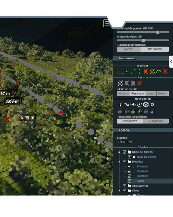
Enrol now in our drone photogrammetry and topography course and acquire all the professional skills in the sector of industry through learning and practical work with real operations in remote sensing, photogrammetry, and thermal and multispectral imaging to model a 3D land surface area, generate plans, and take measurements (lengths, areas, volumes).
- Theoretical and practical training.
- 40 hours of specialisation
- Morning and afternoon times
Upcoming calls
Don’t miss the chance to become an expert pilot in drone topography and join one of our drone photogrammetry courses. Learn in no time from our expert professionals at UMILES University and receive all the necessary certificate to work in what is now a highly sought-after field.

Course 7
From 20 March to 02 April.
Course 8
From 19 June to 02 July.
Course 9
From 11 September to 24 September.
Course 10
From 11 December to 17 December.

The most comprehensive, practical and approved drone photogrammetry course
Thanks to this course, you will be able to make photogrammetric flights with drones, take measurements, and make topographical interpretations of the area from the air, 3D surveys, and much more. In addition, on receiving the training offered at UMILES University, you will obtain a number of additional benefits that are detailed below:
- 40 hours of specialisation.
- Theoretical and practical training.
- Handling of programs for of 3D land surface area and terrain modelling.
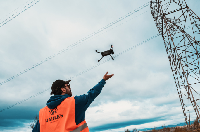
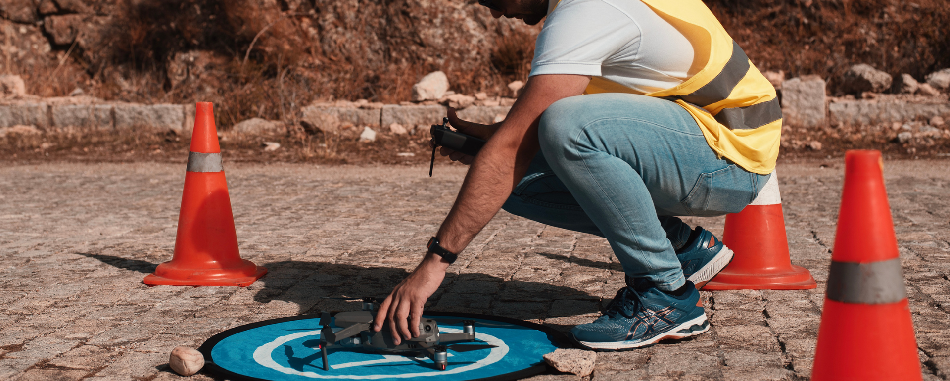
- Flights in real-life situations using photogrammetry, remote sensing, and thermal and multispectral imaging.
UNI VERSITY
Become a photogrammetry drone pilot certified by UMILES University
With our drone pilot course for topography, you will have the chance to become a flight operator for several remote sensing activities.
This specialisation will enable you to begin a career in a growing field of work.
Want to work as a drone pilot for photogrammetry? Call us on 91 113 89 88 and reserve your place now.
Why choose UMILES University?
UMILES University is not only a school for drone pilots but is also one of the organisations to have been officially recognised by AESA to provide practical training on drone flying. This makes us an excellent alternative for becoming a certified pilot, thanks to the fact that our courses are approved by the National Aviation Safety Agency.
We also have over 10 years of experience in the drone industry, with an extensive background in various training areas. We can therefore offer specialisations in different areas, taught by trained professionals.
- 100% in-person training with direct and close contact with our teachers.
- Training courses with AESA-certified quality.
- Large facilities equipped with everything you need for comprehensive training.
- Own aerodrome in Madrid with extensive capacity.
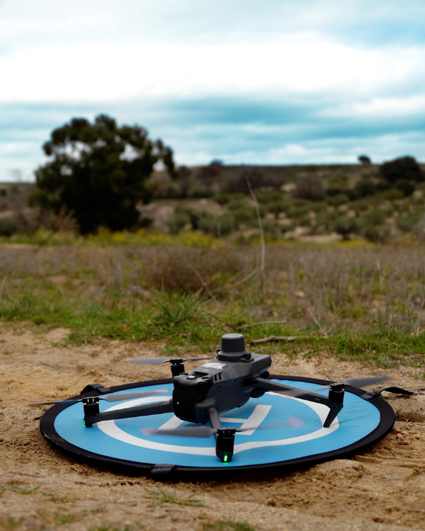
- High-tech drones for practical work during the training process.
What do our students think?
Check out our reviews from students who have had the unique experience of receiving training as professional drone pilots at UMILES University.
Course content and organisation of the drone photogrammetry course
This course takes place in Madrid and has structured content taught by experienced active professionals working in the sector.
This drone topography, photogrammetry and remote sensing course lasts for 40 hours, with classes spread over 2 weeks.
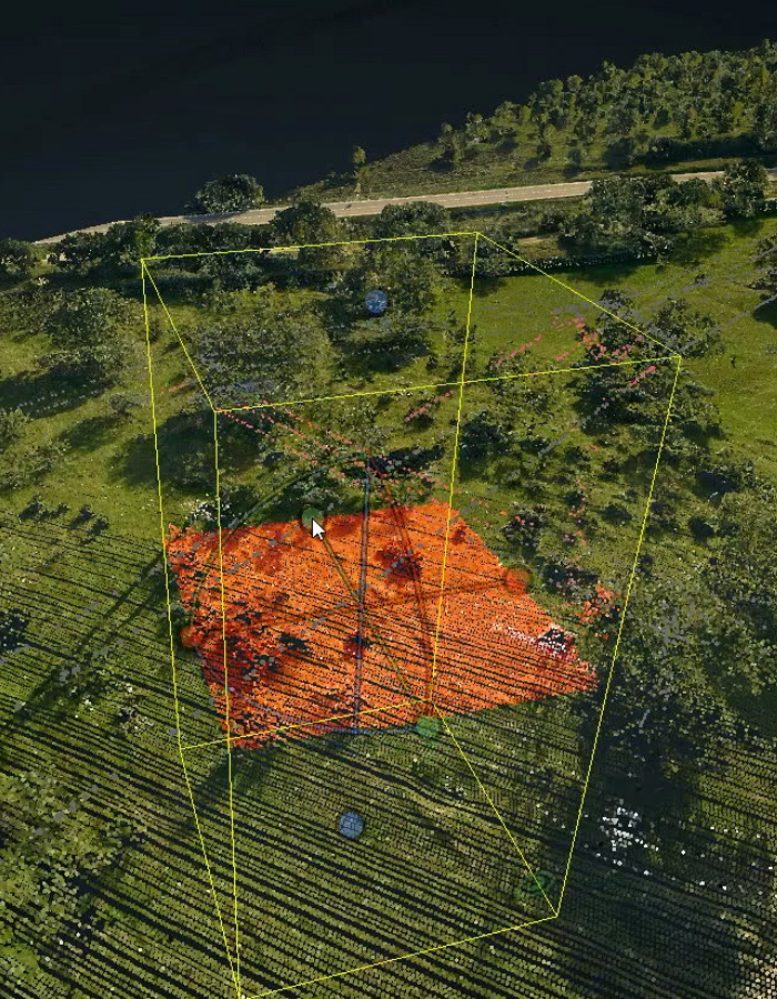
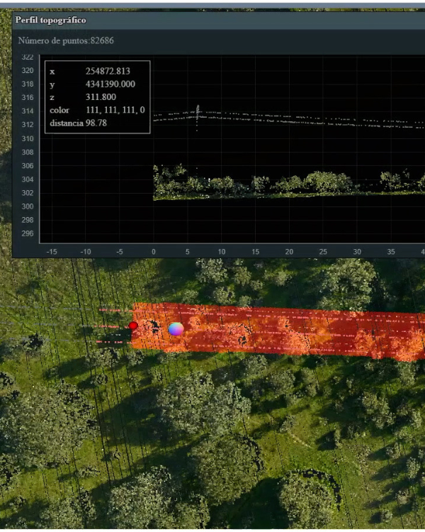
On successfully completing the course, students must be able to take aerial measurements using drones, obtain areas, volumes, and surfaces, reflect the information on plans, and model 3D terrains.
The course structure has been segmented into a theoretical stage and a practical stage:
Theoretical module
The theoretical part of the course covers all necessary knowledge for students to obtain professional skills in the field of photogrammetry, remote sensing, and thermal imaging, so that they are able to work as a professional in:
- Mapping.
- Photogrammetry.
- Geodesy.
- Use of software for data processing, and the generation of plans and 3D models.
Practical module
During this stage, students must demonstrate the skills acquired in the theoretical part, and put the knowledge into practice in order to obtain the necessary skills to work as a professional.
- Photogrammetric flight planning.
- Topographic surveys with a drone.
- Generation of 3D models using photogrammetry.
Apply now for your place
Don’t miss out on your place for this course, which will provide you with the necessary skills to operate drones in the field of surveying and measuring. See the price of the drone topography and photogrammetry course below, along with the upcoming dates planned to begin this specialisation module.
FAQs
Do you have any questions about our drone pilot course for photogrammetry and planimetrics? Check out this list of FAQs, where we answer the most frequent questions.
How do you obtain the drone pilot licence for photogrammetry and planimetrics?
Drone licenses are required for certain specific activities. You must therefore ask about how to obtain a drone licence, depending on the type of flight you will be making and the conditions of the place where you will be flying the UAV. Call us on 91 113 89 88 for assistance or to clear up any queries.
How long does the drone photogrammetry and topography course last?
This drone photogrammetry course lasts for 40 hours, with classes spread over 2 weeks.
Do I need a drone to take the course?
You don’t need a drone to access the training we offer at UMILES University. Our facilities include all the necessary tools for you to receive the high quality training you deserve, and you can then buy your own drone depending on the type of work you are going to do.
See all courses
At UMILES University we are experts in Drone Courses. Below you can see our training offer:
Contact us
Press to call
© 2023 UMILES GROUP. ALL RIGHTS RESERVED
Press to call